Showing posts with label family trek. Show all posts

Huthridurga Trek : When wet and misty


Location: Huthridurga
Date: Dec 10th, 2022
To get there: From Bangalore, go on Tumkur Road, and take the left to Hassan/Mangalore at Nelamangala. Take a deviation towards Hutridurga before you reach Kunigal.
Distance: Apprx 80km. 
Trail type: We were able to do only about a kilometer to the abandoned temple. This part had manually cut steps on the rock with railings for the most part. Rest was easy to walk trails with man-made or organized steps. The final part was a bit steep but still fairly easy.
Facilities: There is a temple with plenty of paid parking hosted by the family staying there. We paid 50rs for our car. Small shops in the village nearby.
MapTrek Start point 

This was one of those constantly talked about but always postponed plans with our Saturday basketball group. Finally, only 4 of us managed to shake off scheduling conflicts and ignore weather predictions (rainy!) and gathered at my house near Thalagattapura around 7am. We carpooled and started off promptly under misty, cloudy, and intermittent drizzle, with rain gear and snacks!

The drive was comfortable on mostly NH roads except for the last 10 or so kilometers. The trek start point is just past a village temple which also provides ample parking space. The family there maintains that and charges a nominal fee to leave your car. Since it was already close to 9am we chose to eat up some of the food we had bought then itself before heading out. I chose to leave my camera behind because of the weather and the threat of heavy rains later. Therefore, our photo shoots had to be with the mid to high-end cell cameras that all of us carried.

So, it was in uncomfortable ponchos and bulky rain jackets that we started up the paved path toward the hills of Hutridurga. However, the ethereal look of the hills shrouded in mist and clouds at the top, wet paths, and washed clean nature more than compensated for the dreary weather. We trudged up the sloping rocks with cut steps with a lot of expectations and energy. Bird watching was minimal with most IDs by calls and little visual activity by Sunbirds, Munias. 

The views were spectacular as we progressed at a very leisurely pace.  Even at 10am, we were the only ones trekking up, understandable as ours was the first car parked and the weather was still poor. It made the trek experience that much more special and personal with invariable photo shoots every 10 steps or so!

After about a kilometer, we reached an abandoned temple structure to the right of the path perched on the edge of the hill. It had a small Kalyani with water. We chose to stop here and go through the rest of our snacks. The place was isolated at that time with spectacular views all around. We stayed there for almost 30 mins, just munching on food, chatting, and catching up with nostalgic, often hilarious stories mostly from our school and college days.

As the weather still did not clear and the higher reaches of the hills remained shrouded in clouds/mist, we decided to climb down and head back. This time we encountered several parties making their way up including a large trek group. Better late than never, I guess. 

We were back at the trailhead by 11am and enjoyed a "productive" photo shoot with the weather clearing a bit and the trail and hills giving us wonderful clean backgrounds. Shortly thereafter, we were back in the car and planning a much-deserved (or not!) lunch self-treat!

As always, when on a trek anywhere, take only memories and photos and leave behind only your footprints. Avoid disposing of all kinds of trash.


Click here for more images.

Return to Hutridurga on 21st Jan 2023


I returned to Hutridurga with a larger group and better weather. This time we reached around 9am after stopping for breakfast at Paakshala@solur on the Mangalore highway. As the weather was good and it was a saturday, we found out just how popular this trek was. Parking was almost full with more cars parked outside the village. The climb until the Temple point was still good though not as scenic. We stopped for 10 mins at this place to rest and continued along the path for another half kilometer or so where we came upon a nice flat area of the peak, which turned out to be an excellent spot for picnic and views. We relaxed here for almost 30 mins with various photo shoot attempts before heading back. Reached the parking place before 12 noon and headed back to Bangalore.

Birding was very poor because of the time of day and lack of focus. However we were lucky to spot the vulnerable Yellow-throated Bulbul and a pair of Egyptian vultures.

Click here for more images.

Backdoor Climb to Nandi Hills


Location
Nandi Hills
To get there: From Bangalore towards Hyderabad past the airport
Distance: Apprx 50km. 
Date: 2nd July 2022
Trail type: Mostly (90%) manually created stone steps.
Facilities: Some roadside eateries at the trailhead where you can park also.
Map: Start point 

I had never really trekked up Nandi Hills in the numerous times I have gone there since my early childhood. We always drove up and if it was for birding we would just stop along the way at suitable birding points and do most of the wonderful Nandi birding at the top like we did on this trip in 2009. However, this time when a friend invited me to come along on a trek to reach the top via a backside trail, it was quite intriguing and I tagged along eagerly. 

We reached the start point around 6.30am. The trailhead has some parking along the road leading up to it. A lot of vendors selling the usual roadside snacks, if you are up for it, are set up here. We had our packed breakfast and chose to start out without any delay. However, kids had their own schedule and we stopped within 15mins for our first round of treats! There are plenty of spots along the way to stop, take in the views, and have a picnic. We did that around 45 mins into the trek. The trail itself is not very long and we reached the top near the Nursery or Temple pond area in just over an hour. We then spent an hour there taking the bus to the Tipu Drop Point and then back. Climbing down was uneventful and quick and we were back in our cars by 9.30 heading back to Bangalore.

Overall an easy climb that you can do as an alternative to going by the busy main road to Nandi Hills and you get some great views and a workout as a bonus! Briding was very poor as the weather was cloudy and rainy some of the time. 

As always, take only pictures and leave only footprints. Do not leave behind any trash on the trails.

Challenging climb for the views


Structure at the top
Location: Skandagiri Peak, Chikkaballapura
To get there: From Bangalore towards Hyderabad past the airport
Distance: Apprx 60km. 
Trail type: Easy hard mud, Rocky with some boulders.
Facilities: Toilets, Forest guards
MapSkandagiri Peak Start point 

Date: Sep 19th, 2022

We planned this trek as preparation for our Sandakphu trek in the Himalayas. It fitted the requirement as it was moderate, close by, and required some climbing and effort testing our fitness levels. The trek can be done only by booking with the Karnataka Eco Tourism who will give permission to take the trail as well as provide a guide to the top.
Facilities at the start point

On the trail

Our group of 12 across 4 families, met at the parking place, Papagni Mutt where there is ample organized parking place. However, it was quite full on the day we went, so better to get there early. From there, it's about 200 or so meters to the trek starting point where there are toilets and the guide will meet you.

Bouldering for fun!
The trek itself was fairly easy if you are reasonably fit and do not have any physical issues. Otherwise, you may find the ascent and the rocky trail in some parts a bit tough. With suitable rests and proper pacing, its still doable. We did stop at couple of places for refreshments and let the kids do some bouldering which they enjoyed. The views are speactacular as always and we can see Nandi Hills from the top. There is an old abandoned temple on a a large granite boulder with remnants of a fort like compound all around. We rested and picniced there. Our birding was quite limited on the trek and the only highlight is we spotted Blue Rock Thrush at the top.

Descent was quick and we all enoyed a well deserved and  rejuvenating tender coconut at the bottom.

As always when on this trail, leave only your footmarks and take only photographs,

Some images that were taken on the trek  (and the ones inserted into this blog (c) Prasanna)


Sandakphu: Trekking for amazing views

Sleeping Buddha (Kumbakarna, Kanchenjunga)
Location
: Sandakphu, West Bengal
Date: Oct 31st to Nov 6th 2021
To get there: [Click here for Google Map].
From Bangalore, flight to Bhagdogra. Then on a Jeep arranged by IndiaHikes(IH) Vehicle to Srikhola where our Base camp (teahouse) and the trailhead were located.
Trail type: Mixed trails. Kutcha roads, paved/pebbled/rocky trails, soft narrow muddy trails, and steep climbs through pine forests on narrow trails. We did not encounter snow at all. I trekked the whole time with camera and binoculars around my neck. So, it's a moderate trek and can be done by anyone who is reasonably fit.
Facilities: Once we left Srikhola, I do not remember any populated places with general stores and such. Samanden was a small village but we did not visit any shops there. Sandakphu on Day 6 is when we started seeing more houses and people but again did not really check out any stores. We had prepared for all our needs during the trek and our food requirements were entirely taken care of by IH. Also, our trek leader explained in detail how IH was prepared to take care of any medical emergency including evacuation if necessary. That was quite comforting.

Everest range (Lhotse, Everest, Makalu)

Himalayas always calls you back, I guess. As with the Kheerganga Trek we did in 2018, this was also initiated by a friend of ours and as then, we did not need to be asked again to return to Himalayas for what looked to be an amazing trek organized by India Hikes or IH. Updated details on this particular trek on their website can be found here.

So, it was that on 31st Oct 2021, 17 of us which included 6 kids, were at Bangalore Airport taking the flight to Baghdogra, then met up with 3 more trekkers there and the 20 us of traveled together in 3 jeeps to reach Srikhola for what turned out to be a trek that gave us all that was promised on paper and much much more. 

As a change from my usual trek writeups, this time I created a photo/video blog with text in it to describe how this trek went. It gives better context and flows with the visual aids to relive our experience. You need to click on the 3 dots on the phone or (i) icon on the laptop to show the text always as you swipe through the images/videos. 


My other photo albums:


Ebird checklists from the trek:


Garmin activity tracker for most of the trails we took with its various metrics:


Campsite at Aal with Sleeping Buddha

A compromised but worthwhile Urban Nature Preserve

Location: Turahalli Tree Park, Bangalore
Date: Nov 12, 2021
To get there: Take the Kanakapura main road. About 6km from Sarakki Signal, you will pass DMart on your left. Take the next right towards Turahalli forest. Turn left opposite Sobha Forest Edge apartments.
Trail type: Broad paved and unpaved paths. It also has extensive narrow trails for exploring the park boundaries.
Facilities: Parking. Benches to sit and relax. Forest officials are present sometimes. Toilet facility has been built but was closed when we went. Gazebo and large viewpoint with plenty of seating to relax.
Rugged trails


This park exists adjacent to the larger Turahalli Forest for public access and enjoyment. The forest and the park are divided by a 100 ft road. The forest itself has been closed off to public access for a few years to protect the flora and fauna from human disturbance. So, the Turahalli tree park is the alternative to experience a bit of the forest ambiance. I say it is compromised because there is much pressure to turn into a normal park solely for the entertainment of us humans than ensuring the well-being of the creatures and plants which inhabit it. For example, a children's play area has come up now. Many statues have been installed, presumably to share nature information with the public, like Tiger, Pangolin. Though the intent is commendable, I feel they don't belong if the idea is to keep the park as natural as possible. Shouldn't information posters be sufficient? But then that's just me and in the minority on this, I am sure.
View point in middle of park
Wide paths

Anyway, back to our visit and I hope yours too sometime soon. Even though this park is very close to our place, we had never gone there mostly because Turahalli Forest was a better option for bird watching. When the forest was close to public, we decided to do a bird walk here with little expectations. About 4 of us managed to make time in the morning and we were at the main gate around 7.30am. A wide path greeted us as soon as we entered the park through the side gate. We chose to take a narrower more natural path by turning right after the gate. Vegetation was quite wild and thick here. We continued until we hit the park bounday near the road and then did a counter clockwise walk along the edge of the park on narrow natural trials. At some points we came inwards a bit to check out the Gazebo and the view points. 
Forest patches
View from gazebo

Overall the park has been maintained well with some healthy undisturbed vegetation in several patches. Most paths are narrow and natural with the exception of some near the gate which are wide with skirtings. An ill adviced childrens play area has come up now. Hopefully it is the first and last! as it does not support the concept of a tree park and will only disturb the wildlife there. Also, my personal opinion is that children should attempt to learn about nature in these types of parks and not to play on man mande structures. We also had a decent birding experience with Small Minivet, Gray-breasted Prinia, Black-shouldered Kite being highlights among others. Click this link for a complete checklist with the images on Ebird. 
City enveloping the park

In spite of some drawbacks, I feel this park is a good step towards creating family and public friendly nature parks which lets the average person experience nature easily. Hope the Karnataka Forest Department, maintians it well and does not succumb to construction pressure and build unnecessary structures that does not fit into a Nature Park. It also relieves pressure on the Turahalli Forest, only true foreast patch within city limits, to be opened up for public.

Enjoy your visit!

Neighborhood water bodies: Jogi Kere

Location: Jogi Kere, near Thallagatapura, Bangalore
Date: Mar 4th, 2021
To get there: [Click here for Google Map].
It is located in South Bangalore on Kanakapura Road in Judicial Layout, Thallagatapura.
Trail type: Paved walking path going around the Lake for 0.5 km
Facilities: None at the lake as of now. 
Spot-billed Duck

Sometimes we travel a long distance to see birds but ignore good birding places in our neighborhood gardens and nearby lakes. For these, all you need is a couple of hours of free time. Binoculars and shoes are optional! Previously, I had written about other city lakes, Puttenahalli Kere and Doddakallasandra Lake. This time, we visited one such lake, smaller but close enough to just walk to it.

Rosy Starlings
Jogi Kere is that water body to which we paid a visit, a mere 1km walk from our residence. Kere  translates to lake in Kannada language and Jogi means a hermit in many Indian languages. Surely, this lake is where one can meditate in the midst of nature! Jogi Kere will barely make the cut as a lake, but it has been cleaned up recently by local folks, government agencies, and NGOs. Sewage inflow is cut for the most part and the foliage in the island and boundaries are beginning to show signs of recovery. The lake itself, unfortunately, follows the ill-advised design of a soup bowl with rocky embankment all around and a walking path on the bund thereby denying the much-needed shore and vegetation near the waterbody for birds to thrive. But somehow nature overcomes and thrives!

Little Cormorant
It was a sunny weekday morning when 6 adults and 4 kids which formed our group started out after 7am on the path towards the lake. It passed through some undeveloped land with plenty of shrubs and trees. So, our birding started early as we spotted wagtails, robins, parakeets, bulbuls, etc., and stretched a 15 min quick walk into a 45 min exciting stroll. We could hear the Red-wattled Lapwing calling as we neared the lake. There is only one entrance at a corner and we were greeted by a mixture of water birds immediately, as we passed through it. Spot-billed ducks, Little Grebe, Little Cormorant, Eurasian Coot, Common Moorhen were on the welcoming committee. As we took in the birding bounty, there was a lot of energy and commotion on the large tree opposite dominated by Rosy Starlings, Mynahs, and Parakeets flying in and out constantly. A solitary Coucal decided to join the fun by hopping over the fence and climbing the tree. We suddenly saw a flash of blue streaking over the water and perch on a concrete platform nearby. Lo and behold, the very colorful Common Kingfisher had made its appearance and obliged us by staying there for a while. Walking around the lake we managed to spot few more birds like Pond Heron, Indian Robin, Pied Bushchat under the constant chatter of the migratory Starlings which were there in huge numbers.
Common Kingfisher

After a leisurely stroll around the lake, we walked across the road to check in on an abandoned quarry opposite the lake which because it's isolated completely usually has some surprises. This time it was a flock of 10 Lesser Whistling-ducks and a solitary Purple Swamphen among other water birds. By this time the sun was up and it started getting hot. We headed back to our place and finished the neighborhood lake bird walk in around 2 hours. 

Overall, it was a wonderful experience for all. Easy walk to experience a healthy urban bird diversity spot in our neighborhood itself. Good luck and kudos to all the workers and volunteers, who are making this experience possible and fighting to retain the water body without letting it get destroyed or encroached. Bangalore needs every one of these gems, big and small, to remain in a healthy natural state for the survival of our feathered friends.

Selected images taken during our visits here can be viewed at the link below.

Jogi Kere Bird Images

Checklist of birds seen on Ebird


Lesser Whistling-ducks


Bidarakatte : A Scenic Trek

Location: Bidarakatte, Next to Savandurga, Near Bangalore
Date:  Oct 11th, 2020

To get there: [Click here for Google Map].  Take Mysore road towards Ramanagaram. Take a right from Ramanagara bus station and head straight for around 40 minutes. Take a right under the arch saying - Kempegowda Vanadhama Savanadurga to reach the Ramanagar division forest department in about 5 minutes. Check Forest Dept directions also for any updated information and also for booking (250 Rs/person) the trek as only guided treks are allowed here. There is another shorter route through Manchinbele, which we took on our way back.

Distance: About 50 to 60km from Jayanagar, Bangalore

Trekkers on the trail
Trail type:  Around 3 to 4 km one way if you take the longer scenic path that our guide chose on the way to the destination point. Less than 2 km with a short cut which we took on the way back. About 80% of the trail is walking on rocky mountains or monoliths. For an experienced and well-balanced trekker, this will be a breeze. But for those of us on the wrong side of the age curve or with some balance fears, this trek will feel very adventurous even though danger is minimal. Regardless, one has to be a bit careful where the slope becomes steep. In a few places, it is easier to slide down on our butts unglamorously than walk down in style. I chose the former! Note that it can get quite treacherous with rain or even a drizzle. Rubber-soled shoes with a good grip are ideal footwear.

Facilities: Ramnagar is a big town to stock up on any essentials if you are leaving Bangalore too early. A lot of village shops can be found on the way. Trailhead has a Forest Dept office with parking, drinking water, and basic toilet facilities. Warning: Toilet is usable but not clean.


It had been a while since we had gone on any group family trek close by. When a close friend suggested this half-day trek to get relief from the covid mandated incarceration, that drought finally came to an end. Bidarakatte is one of a set of eco trails that the Karnataka Forest Dept is managing and would be a first for us. Only small groups with guides are allowed on the trail with pre-booking. Our group of 6 was to start at 7.30 am. 

Up early, too early, on the trek day, with packed breakfast, we managed to pile into their XUV, delayed by only 15 mins from the 5.30am departure time. Taking some short cut village roads on a very cloudy day with the threat of rain, we reached the destination pretty much on time. We found the guide ready along with 3 others who would make up the full party of 10 now.

Waterfall
Endpoint of Savandurga Trek
Masks on initially, we headed down an easy path to what appeared to be a man-made lake. Scenic with the Savandurga Monolithic rock face towering over it. We didn't linger long and doubled back to head out on the actual trail along the foothills of the rock face. Calls of Sunbirds, White-browed Bulbul, Coucal could be heard but any movement was absent. No doubt, the birds were smarter to stay warm wherever they were instead of flying around in the dreary weather like us, humans. We did spot the tail of what looked like a Malkoha but the bird itself was too well hidden among the leaves to make a positive ID. 
Soon we came out onto massive rocky outcrops, with lots of small pools of water and cacti. Add in lush forest greenery in the ravines and the tall Sanvandurga monolith backdrop, the views were spectacular. Any angle was a keeper for a landscape photographer. Walking on the rocks is easy as long as you are careful and take it slow. We had to pass through remnants of a fort which was quite exciting and aesthetically very beautiful. As we walked along the broad ridges, we could see the valley below with several villages. 

Temple at endpoint
Indian Grey Mangoose
We reached the old abandoned temple in around 2 to 3 hours, stopping only for views and photos. The temple area overlooks a heavily forested ravine and some fort ramparts. Lots of great places to sit and enjoy a picnic breakfast while getting stunning views any which way you turn. Bird watching was a little more fruitful here with Blue Rock Thrush, Rufous Treepie, Egyptian vulture, Peregrine Falcon, and a nice flyby of a Tawny Eagle. A pair of Indian Grey Mangoose, scuttled along the edges giving curious glances at us.
Blue Rock Thrush

After spending a relaxed hour here, eating, birdwatching, exploring, or just lying back and staring at the skies, we headed back with rain, thankfully, still playing truant. As our guide chose a shorter route, we were back at the parking lot within an hour.

Overall, it is a great hike, close to the city with clean thick, and healthy forests. Add in the stunning views of rocks, pools, and fort ramparts, it is truly a gem. I sincerely hope the Karnataka Forest Dept maintains it the same way forever and with only guided treks.

As always, if you do choose to experience this trek, take only photos and leave only your footprints. I mean don't litter or damage the pristine environment.

Tawny Eagle
Some more photos are here.

Ebird Checklist for the avian curious.  As noted before we did miss a Malkoha and I think one other raptor and probably a few others whose calls we heard but could not ID.

Jog Falls - Natural beauty

Location: Jog Falls, Karnataka, India

Date: Oct 30th and Nov 1st, 2019

To get there: [Click here for Google Map].
From Bangalore, it is connected by Train and Bus. Driving takes around 6 hours on pretty good roads for the most part.

Trail type: This is a tourist spot. We did not trek in the proper sense. However, the main Mayura viewpoint of the falls is well developed and managed by the tourism department.  One can walk among the ramps to get different views at the top. For the fit and adventurous, they have constructed steps, 1388 in total, to reach the foot of the falls. This, in essence, was our "trek". The stair access is only from 9am to 4pm. Allocate 2 hours or more for this option to have a pleasant experience. The other public viewpoint at the British Bungalow side also has some ramps to walk around and gives a different perspective of the falls.

Facilities: Restaurants and small shops are present. Public restrooms are also there though we did not use it. HDFC ATM booth is also there. Plenty of car parking at both viewpoints.


It was disheartening for me to not have visited Jog Falls since my school days. That finally came to an end when we had to attend a family function at Shimoga to which we added a one-night stay-over near the falls. The Falls is about 100 kilometers from Shimoga and takes 2 hours drive time.

Our aim was to leave Bangalore by 6am and we missed it by 30 mins, even though packing was just dumping all our clothes and snacks into the car! Note that there are not many eating places on this route after Tumkur. We ended up eating at a small roadside restaurant in Hosadurga, which surprisingly had good Masala Dosa. Lunch was at Sagar 1 hr before the falls at a riverside hotel. Unfortunately, there was no bird activity on the lake. On the way back from Shimoga, we were recommended a much better hotel near Tarikere called Aramane.
View from Mayura

Gray or Hanuman Langur with a better view!
There were not many spots on the way either where we could do some roadside birding. So, we reached the Falls at the expected time of 2.30pm. Since the weather was fine, we just checked in and immediately headed towards the main viewpoint at Mayura Hotels. It is well managed here with ample parking space though I am guessing, it may overflow on popular days.

It was just after 3pm and we inquired about the steps to go down to the foot of the falls. We were told that the pathway closes by 4pm. So, after taking in a quick glance at the falls we hurried over to the steps. Its a total of 1380! but undaunted we started down fast. However, rain played the spoilsport and at about 80% down, we had to surrender and head back up. Our plan was to return the next day.
Clouds coming across

Stairs to the base
As we were told the route will be open for public at 9am, we started out first birding near our resort around 7am and then drove to British Bungalow for the fall views. Here also there are nice viewpoints and you can see and hear Roarer up close. However, the other falls are partially or fully hidden. We then drove on to the Mayura viewpoint (around 2 km) and started down the steps at 9am prompt as soon as the guard opened it. These 2 guards will go down and stay until the closing time at 4pm to prevent any untoward incidents. This time the descent was more leisurely and we enjoyed the views along the way. Birding wise, we were given a spectacular posing by Asian Fairy Bluebird which sat and posed for few mins just a few feet in front of us. Mountain imperial pigeon and small minivets were also seen.
Resting in gazebo at the start of the steps

At the bottom, they have created a small enclosure where one can wade in water from a small runoff falls. No one is allowed close to the bigger ones. We were told that when the falls are in full flow, the water will spray all the way to the enclosure. It was not the case for us as the flow was restricted. We spent about an hour there before heading up. We spotted only Pigeons and Egrets here. The Rock pigeons were perched in rock crevices naturally unlike their urban friends (or cousins?) who prefer the man-made tall structures. Hundreds of them if observed carefully tended to fly out in a flock once in a while.

It was a great trip and we were finally happy to have seen Jog Falls in all its beauty and take in the wonderful nature around it.

Bird list:  https://ebird.org/checklist/S61921322
At the base of the falls


Back to the Himalayas: Kheerganga Trek

LocationKheerganga or Khir Ganga, Himachal Pradesh
Date: Apr 15 to 17th 2018
To get there: [Click here for Google Map].
From Bangalore, flight to Chandigarh. Bus or Taxi from there to Bhuntar. Then IndiaHikes Vehicle to Barshaini where the trail head is.
Trail type: Wide well worn trail. I trekked the whole time with camera and binoculars in hand. On weekends, we were told the trail attracts lot of people so can get noisy and crowded.
Facilities: Small makeshift shops selling snacks and drinks in few places along the trail. Please avoid buying anything packaged in plastic here to reduce demand and thereby the litter. At Kheerganga, lot of small scale shops and restaurants have come up in tent like structures.


The urge to to go back to Himalayas is always strong once you experience it. All the difficulties, cold weather and hardships of the previous trek, which in our case was Dzongri-La, is quickly forgotten replaced only with memories of pristine mountains and streams, colorful birds, fresh air and the majestic peaks of Himalayas. The hard part is always the planning with conflicting schedules within family or friends group. So, in this case when an initial idea of a moderate trek "somewhere in North India" was proposed by friends on dates that worked for us, we did not need to be asked twice! It all fell into place fairly quickly, thanks to the enthusiasm and purposeful determination of the initial planners. Once the destination and trek conductors, KheerGanga and Indiahikes, were selected, we had rest of the logistics organized within a short time. Finally, we were 5 families making it a fairly large group of 15 with ages ranging from 10 to over 50!

The excitement increased with each day of planning as the D-day got closer. The trek pick up point by India Hikes was at Bhuntar, but we decided to go 2 days early and stay close by. This way we got a bit more of the Himalayas and also some acclimatization before the bigger trek. The place we chose was Usha Homestay, Tirthan Valley, Gushaini. It turned out to be a good decision. Place was scenic with a river view and we were well looked after. On our first day, we did a day trek to Serolsar lake from Jalori Pass. Trek is long but easy as the trail is flat at around 3000 mtrs. So, it served our objective and also got us some fantastic views of the mountains. Second day, we mostly relaxed around the resort preparing for the bigger one ahead.

The place was fantastic for bird watching too. The Plumbeous and White-Capped Redstarts were right on our doorstep in the river. We also, got our heart-fill of Yellow-billed Magpie, Russet Sparrow, Black-bulbul and Grey-hooded Warbler seen often around the place. Highlight was a good sighting of Great Barbet.
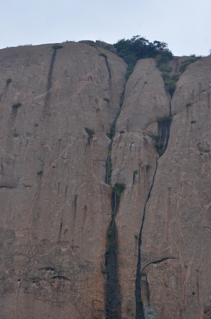
Just starting at Barshaini

Day 1 of Kheerganga Trek.

We were up early and thanks to a round of hot tea, loaded and ready to leave for Bhuntar by 5.30am.  It was an adventurous drive along winding roads with a steep edge and river below most of the time which is typical of hill roads in Himachal Pradesh. We reached our pick up point on time at 7am. India Hikes had arranged two vehicles for us to drive to the Trail Head, Barshaini Village. After another longer similar drive, we reached Barshaini late morning. Our trek leader Samkit was waiting for us at a small restaurant. 6 others joined, making it a total of 21 in the group. We were offered an early lunch, which we could also pack to eat on the trail. After the trek briefing, he gave us each a litter bag to fill during out trek. One of many initiatives that India Hikes takes to keep the trail clean and treks environment friendly. (More about them in the end).
Up we go..

Parbati River 
Soon, we were finally on our way trudging along on the tar road leading out of the village towards the mountains. We crossed the river over a dam like structure and were immediately on a mountain trail heading deeper into the forest. As expected the teens and yet to be teens with their youthful exuberance surged ahead competing with anyone in the group who dared to go faster. Few of us with binoculars and insisting on following up each movement or call of a bird lest we miss some exotic species lagged behind. Rest made up the middle focusing on the task at hand which was to cover 10+ km at a steady pace!

The trail was beautiful all along with Parbati River on our left, way down below at about 50 to 100 meters. The path was easy most of the time with some steep parts needing care and hand/stick support to cross. Many mountain streams crossed the trail. It was a pleasure to fill our water bottles with the icy cold water straight from these streams.

Rest stop
We made few stops along the way. First was at a a make shift snack place with a wide expanse of grass. Samkit immediately put us to work to collect the litter and of course we hit a treasure trove of plastic all over! Other stops, were for rest and some nourishment where the laggers (read birders) could catch up with the group.

Birding along the way was tough as expected because of the dense canopy and steep edges. We got to see Himalayan Woodpecker, Creepers, Bule-whistling Thrush and Long-tailed Minivet. At the end a Himalayan Bluetail gave us good poses for a long time.
Himalayan Woodpecker

We reached KheerGanga around 6. An exhausted group trudged the final half km steep climb to our campsite.  Immediately all the tiredness was gone as we took in the scenic background with the towering Himalayan mountain range all around. The advance India Hikes team was already there preparing dinner for us. Samkit put us through some stretching routines to loosen our aching and tight muscles. Then he gave us instructions on how to setup tents which we all had fun doing. Then mats, sleeping bags were all setup up with 3 to each tent. Dinner was served at a large and cosy dining tent with Samkit doling out rotis, sabji and desert. Maybe its the cold mountain air or the exhaustion of the trek but any hot food tastes divine in the Himalayas and miracle of miracles, kids rarely complain and leave nothing on the plate!
Natural water station!


Day 2 

The original itinerary was to have breakfast, break camp and head to Buni-buni pass. But due to heavy snow on that trail, it was cancelled. Instead, Samkit planned a small but strenuous trek to a view point just behind our campsite. After a leisurely breakfast, we set out around 9am. Almost immediately the climb turned very steep with lot of switch backs. Constant rest was required even though the top looked tantalizingly close. We hit couple of snow patches to everyone's delight leading to some friendly snow fights. As we crested the top, we were greeted with an awesome view of the snow clad mountain range.

View point
The view point is a massive meadow surrounded by mountains. It was a pleasant couple of hours spent just clicking pictures, lounging around and having snacks. With thunder and some dark clouds coming in, we reluctantly headed back to camp. The climb down, though not physically hard, was equally if not more difficult with the chance of slipping and falling higher. In fact several of us did and had to be helped up. Rain did catch up with us as we neared the campsite. However, most were happy with that as it gave them a chance to try out brand new ponchos or other rain gear bought specifically for this trip.

The field behind the campsite was a great place for birding. Finches, Bushchat and Thrushes could be watched up close by just finding a nice spot on a rock and sitting still which some of us did most of the evening. Others relaxed in the tents and after our evening tea and snacks, all joined in for some hilarious games of Bluff.

Day 3

Wild flowers 
There is always a mixed feeling on the final day of a nature camping. On on side we feel reluctant to leave the beautiful and pristine nature but on the other look forward to a comfortable bed and toilets with flushes. Given the choice, most of us would have loved to stay couple more days, I feel. But all good things must come to an end, as the cliche goes. So, soon after breakfast, the packing started.

Unknown Butterfly
Samkit gave us a demonstration on how to take down a tent. It was voluntary exercise but of course everyone rose to the challenge to be the fastest or the neatest or whichever would make them come first! Very soon all the tents were down, backpacks neatly piled up and we were ready to head back down.

We took the same trail back to Barshaini. We broke into 3 groups as before into the energetic teens, practical middle and the slow birders. Each group had its share of adventures on what was supposed to be quick 3 hour trek. The middle got lost and were almost run over my horses who claim the narrow trail to be their own! (Hint: Stay on the mountain side and let them cross, if that happens to you) The birders also got lost and did a longer trail by 2km, crossing the valley to the other side and going through the small village of Nakthan. All had to contend with rain towards the end. But, it all added to the experience and got us bonus moments which we will surely cherish.

Back to base!
Nature wise on this day, we got to see the Bar-tailed Creeper up close as well as the Himalayan Woodpecker. Also got to see the small but colorful Fire-capped Tit. We also caught sight of a wild simian as it sauntered on the opposite hill giving us a look and then disappearing. Our guess is it is Grey Langur or could it be the endangered Kashmir Grey Langur?

We reached Barshaini late afternoon. After refreshing ourselves, we got on the cabs for the long drive back to Bhuntar to catch our bus to Chandigarh where clean beds and other modern amenities awaited us. I am sure we deserved them after being without for 3 days!

Misc Links:
Our Trek Photos

A few words on India Hikes, my first with them. They are a unique company as their goal is not profit but to discover and document trails to enable people to go by themselves! Incredible. Therefore their cost is very low and they share all details of the trails on their website. At the end of our trek, we were told that this particular trek is free for us to repeat anytime in our lifetime. Have to take up on that offer!  Also, they are very environmentally conscious in various ways. 1) Request the trekkers to get our own utensils both to save on disposables as well as for better hygiene and reduction in logistics if they have to carry themselves. 2) Gave each trekker a litter bag to pick on the trails. Needless to say most of our bags were full by the time we reached the end! 3) Encouraged us to carry our backpacks to reduce the impact on trails as otherwise we would need more porters and mules.

Needless to add, they made us follow my motto. Leave only footprints and take only pictures!